File:Thailand location map.svg

Size of this PNG preview of this SVG file: ༣༤༡ × ༦༠༠ pixels. Other resolutions: ༡༣༦ × ༢༤༠ pixels | ༢༧༣ × ༤༨༠ pixels | ༤༣༦ × ༧༦༨ pixels | ༥༨༢ × ༡,༠༢༤ pixels | ༡,༡༦༤ × ༢,༠༤༨ pixels | ༡,༠༥༡ × ༡,༨༤༩ pixels.
ཐོག་མའི་ཡིག་ཆ། (SVG file, nominally ༡,༠༥༡ × ༡,༨༤༩ pixels, file size: ༦༦༢ KB)
བསྡུས་དོན།
| Description |
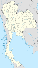
Deutsch: Positionskarte von Thailand
Quadratische Plattkarte, N-S-Streckung 103 %. Geographische Begrenzung der Karte:
English: Location map of Thailand
Equirectangular projection, N/S stretching 103 %. Geographic limits of the map:
|
| Date | |
| Source |
Own work, using
|
| Author | NordNordWest |

|
This map has been made or improved in the German Kartenwerkstatt (Map Lab). You can propose maps to improve as well.
|
གན་རྒྱ་ནང་ཞུགས་པ།
I, the copyright holder of this work, hereby publish it under the following licenses:

|
Permission is granted to copy, distribute and/or modify this document under the terms of the GNU Free Documentation License, Version 1.2 or any later version published by the Free Software Foundation; with no Invariant Sections, no Front-Cover Texts, and no Back-Cover Texts. A copy of the license is included in the section entitled GNU Free Documentation License. |
This file is licensed under the Creative Commons Attribution 3.0 Unported license.
- You are free:
- to share – to copy, distribute and transmit the work
- to remix – to adapt the work
- Under the following conditions:
- attribution – You must give appropriate credit, provide a link to the license, and indicate if changes were made. You may do so in any reasonable manner, but not in any way that suggests the licensor endorses you or your use.
You may select the license of your choice.
ཡིག་ཆའི་ལོ་རྒྱུས།
ཟླ་ཚེས་/དུས་ཚོད་གནུན་ཏེ་རྩོམ་ཡིག་ལ་ལྟ་བ།
| ཚེས་གྲངས། / དུས་ཚོད། | བསྡུས་དོན། | ཚད། | སྤྱོད་མི། | བསམ་ཚུལ། | |
|---|---|---|---|---|---|
| ད་ལྟ། | ༡༣:༠༥, ༢༢ ཟླ་གསུམ། ༢༠༡༡ | | ༡,༠༥༡ × ༡,༨༤༩ (༦༦༢ KB) | NordNordWest | update, new province |
| ༡༨:༠༠, ༡༤ ཟླ་བཞི་བ། ༢༠༠༩ |  | ༡,༠༥༢ × ༡,༨༤༩ (༡.༠༤ MB) | NordNordWest | corr | |
| ༡༩:༥༧, ༢༩ ཟླ་གསུམ། ༢༠༠༩ |  | ༡,༠༥༣ × ༡,༨༥༢ (༩༢༤ KB) | NordNordWest | corr | |
| ༡༨:༠༣, ༢༩ ཟླ་གསུམ། ༢༠༠༩ |  | ༡,༠༥༣ × ༡,༨༥༢ (༩༢༤ KB) | NordNordWest | corr | |
| ༡༩:༠༨, ༢༨ ཟླ་གསུམ། ༢༠༠༩ |  | ༡,༠༥༣ × ༡,༨༥༢ (༩༢༥ KB) | NordNordWest | {{Information |Description= {{de|Positionskarte von Thailand}} Quadratische Plattkarte, N-S-Streckung 103 %. Geographische Begrenzung der Karte: * N: 20.6° N * S: 5.4° N * W: 97.1° O * O: 106.0° O {{en|Location map of [[:en:Thailand|T |
ཡིག་ཆ་བེད་སྤྱོད་ཁུལ།
There are no pages that use this file.
Global file usage
The following other wikis use this file:
- Usage on af.wikipedia.org
- Usage on als.wikipedia.org
- Usage on an.wikipedia.org
- Usage on ar.wikipedia.org
- Usage on ast.wikipedia.org
- Usage on az.wikipedia.org
- Usage on ba.wikipedia.org
- Usage on be-tarask.wikipedia.org
- Usage on be.wikipedia.org
View more global usage of this file.