File:Brahmaputra-verlaufsgebiet.jpg
Size of this preview: ༨༠༠ × ༥༢༣ pixels. Other resolutions: ༣༢༠ × ༢༠༩ pixels | ༦༤༠ × ༤༡༨ pixels | ༡,༠༢༤ × ༦༦༩ pixels | ༡,༢༨༠ × ༨༣༦ pixels.
ཐོག་མའི་ཡིག་ཆ། (༡,༢༨༠ × ༨༣༦ བརྙན་རྒྱུ།, ཡིག་ཆ་ཆེ་ཆུང།: ༢༩༦ KB, རྣམ་གཞག།: image/jpeg)
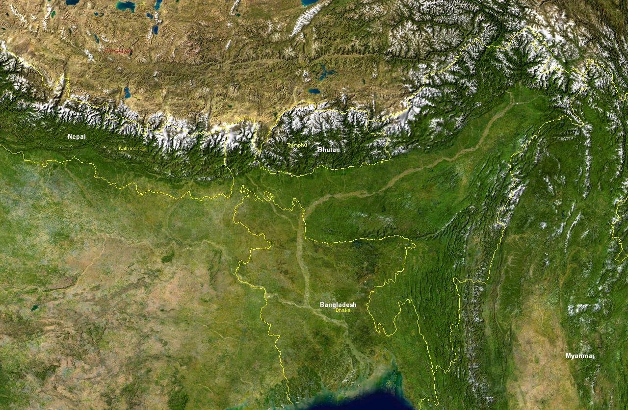
Verlaufsgebiet des Brahmaputra.
Aufnahme der "Blue Marble" (MODIS) mit eingezeichneten Staatsgrenzen, Staatsbezeichnungen, wichtige Städten sowie der Beschriftung "Himalaya".
| This file is in the public domain in the United States because it was solely created by NASA. NASA copyright policy states that "NASA material is not protected by copyright unless noted". (See Template:PD-USGov, NASA copyright policy page or JPL Image Use Policy.) | ||
 |
Warnings:
|
ཡིག་ཆའི་ལོ་རྒྱུས།
ཟླ་ཚེས་/དུས་ཚོད་གནུན་ཏེ་རྩོམ་ཡིག་ལ་ལྟ་བ།
| ཚེས་གྲངས། / དུས་ཚོད། | བསྡུས་དོན། | ཚད། | སྤྱོད་མི། | བསམ་ཚུལ། | |
|---|---|---|---|---|---|
| ད་ལྟ། | ༡༦:༣༦, ༢༩ ཟླ་བཅུ་གཅིག་པ། ༢༠༠༤ | | ༡,༢༨༠ × ༨༣༦ (༢༩༦ KB) | MartinaRoell | Verlaufsgebiet des Brahmaputra |
ཡིག་ཆ་བེད་སྤྱོད་ཁུལ།
pagelinks འདི་ལ་སྦྲེལ་ཡོད།
Global file usage
The following other wikis use this file:
- Usage on as.wikipedia.org
- Usage on ba.wikipedia.org
- Usage on bn.wikipedia.org
- Usage on cs.wikipedia.org
- Usage on da.wikipedia.org
- Usage on es.wikipedia.org
- Usage on et.wikipedia.org
- Usage on fr.wikipedia.org
- Usage on he.wikipedia.org
- Usage on hu.wikipedia.org
- Usage on id.wikipedia.org
- Usage on is.wikipedia.org
- Usage on it.wikipedia.org
- Usage on ja.wikipedia.org
- Usage on jv.wikipedia.org
- Usage on km.wikipedia.org
- Usage on kn.wikipedia.org
- Usage on lmo.wikipedia.org
- Usage on ml.wikipedia.org
- Usage on nn.wikipedia.org
- Usage on pl.wikipedia.org
- Usage on pt.wikipedia.org
- Usage on ru.wikipedia.org
- Usage on sl.wikipedia.org
- Usage on sv.wikipedia.org
- Usage on ta.wikipedia.org
- Usage on te.wikipedia.org
- Usage on uk.wikipedia.org
- Usage on vi.wikipedia.org
- Usage on xmf.wikipedia.org
- Usage on zh.wikipedia.org