File:CHL orthographic.svg

Size of this PNG preview of this SVG file: ༥༥༡ × ༥༥༡ pixels. Other resolutions: ༢༤༠ × ༢༤༠ pixels | ༤༨༠ × ༤༨༠ pixels | ༧༦༨ × ༧༦༨ pixels | ༡,༠༢༤ × ༡,༠༢༤ pixels | ༢,༠༤༨ × ༢,༠༤༨ pixels.
ཐོག་མའི་ཡིག་ཆ། (SVG file, nominally ༥༥༡ × ༥༥༡ pixels, file size: ༡,༠༡༢ KB)
བསྡུས་དོན།
| Description |
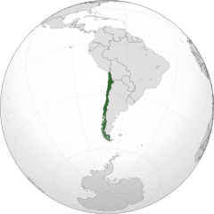
Čeština: Ortografická mapa Chile zaměřená na 37° severní šířky, 71° západní délky.
Oficiální území.
Nárokovaná území. English: A map of the hemisphere centred on -71, -37, using an orthographic projection, created using gringer's Perl script with Natural Earth Data (1:50000 resolution, simplified to 0.25px).
Chile is highlighted in green. Official territory.
Claimed territories. |
| Date | |
| Source | Own work with Natural Earth Data |
| Author | Addicted04 |
| SVG genesis |
.svg)
.svg)
.svg)
.svg)
.svg)
.svg)
.svg)
.svg)
.svg)
.svg)
.svg)
.svg)
.svg)
.svg)
.svg)
.svg)
.svg)
.svg)
.svg)
.svg)
.svg)
.svg)
.svg)
.svg)
.svg)
.svg)
.svg)
.svg)
.svg)
.svg)
.svg)
.svg)
.svg)
.svg)
.svg)
.svg)
.svg)
.svg)
.svg)
.svg)
.svg)
.svg)
.svg)
.svg)
.svg)
.svg)
.svg)
.svg)
.svg)
.svg)
.svg)
.svg)
.svg)
.svg)
.svg)
.svg)
.svg)
.svg)
.svg)
.svg)
.svg)
.svg)
.svg)
.svg)
.svg)
.svg)
.svg)
.svg)
.svg)
.svg)
.svg)
.svg)
.svg)
.svg)

.svg)

.svg)

.svg)
.svg)
.svg)
.svg)
.svg)
.svg)
.svg)


.svg)
.svg)
.svg)
.svg)
.svg)
.svg)
.svg)

.svg)
.svg)
.svg)
.svg)
.svg)
.svg)
.svg)
.svg)
.svg)

.svg)
.svg)
.svg)
.svg)
.svg)
.svg)
.svg)
_without_national_boundaries.svg)
.svg)
.svg)
.svg)
.svg)
.svg)
.svg)

.svg)
.svg)
.png)
.svg)
.svg)
.svg)
.svg)

.svg)
.svg)
.svg)
.svg)
.svg)
.svg)
.svg)
.svg)
.svg)
.svg)
.svg)

.svg)
.svg)
.svg)
.svg)
.svg)
.svg)
.svg)
.svg)
.svg)

.svg)
.svg)

.svg)
.svg)
.svg)
.svg)
.svg)
.svg)
.svg)
.svg)
.svg)
.svg)
.svg)
.svg)
.svg)
.svg)
.svg)
.svg)
.svg)
.svg)
.svg)
.svg)
.svg)
.svg)
.svg)
.svg)
.svg)
.svg)
.svg)
_-_Crimea_disputed.svg)
.svg)
.svg)
.svg)
.svg)
.svg)
.svg)
.svg)
.svg)
.svg)
.svg)
.svg)
_political.svg)
.svg)
.svg)
.svg)
.svg)
_-_Crimea_disputed_-_no_borders.svg)
.svg)
.svg)
.svg)
.svg)
.svg)
.svg)
.svg)
.svg)
.svg)
.svg)
.svg)

.svg)
.svg)
.svg)

.png)
.svg)
.svg)
.svg)
.svg)
.svg)
.svg)
.svg)
.svg)
.svg)
.svg)
.svg)
.svg)
.svg)
.svg)
.svg)
.svg)
.svg)
.svg)
.svg)
.svg)
.svg)
.svg)
.svg)
.svg)
.svg)
.svg)
.svg)
.svg)
.svg)
.svg)
.svg)
.svg)
.svg)
.svg)
.png)
.svg)
.svg)
.svg)
_(orthographic_projection).png)
| Orthographic projections maps created by Ssolbergj |
|---|
| Orthographic projections maps created by Ssolbergj: |
.svg)
.svg)
གན་རྒྱ་ནང་ཞུགས་པ།
| I, the copyright holder of this work, release this work into the public domain. This applies worldwide. In some countries this may not be legally possible; if so: I grant anyone the right to use this work for any purpose, without any conditions, unless such conditions are required by law. |
ཡིག་ཆའི་ལོ་རྒྱུས།
ཟླ་ཚེས་/དུས་ཚོད་གནུན་ཏེ་རྩོམ་ཡིག་ལ་ལྟ་བ།
| ཚེས་གྲངས། / དུས་ཚོད། | བསྡུས་དོན། | ཚད། | སྤྱོད་མི། | བསམ་ཚུལ། | |
|---|---|---|---|---|---|
| ད་ལྟ། | ༢༣:༡༤, ༡༩ ཟླ་དང་པོ། ༢༠༡༤ | | ༥༥༡ × ༥༥༡ (༡,༠༡༢ KB) | Addicted04 | New map, Chile ''de facto'' only, for claims see File:CHL orthographic (+all claims).svg |
| ༢༠:༢༡, ༡༢ ཟླ་དགུ་བ། ༢༠༡༢ |  | ༥༥༠ × ༥༥༠ (༤༩༦ KB) | Palosirkka | Scrubbed with http://codedread.com/scour/ | |
| ༢༢:༥༦, ༢༢ ཟླ་བཅུ་བ། ༢༠༡༡ |  | ༥༥༠ × ༥༥༠ (༧༠༧ KB) | Addicted04 | claimed color | |
| ༢༢:༠༨, ༢༢ ཟླ་བཅུ་བ། ༢༠༡༡ |  | ༥༥༠ × ༥༥༠ (༧༠༧ KB) | Addicted04 | claimed color | |
| ༢༠:༣༡, ༡༤ ཟླ་བཅུ་བ། ༢༠༡༡ |  | ༥༥༠ × ༥༥༠ (༧༠༧ KB) | Addicted04 | New map | |
| ༠༡:༡༢, ༦ ཟླ་བཅུ་གཅིག་པ། ༢༠༡༠ |  | ༥༥༠ × ༥༥༠ (༦༤༢ KB) | Addicted04 | {{Information |Description={{en|1=Orthographic map of Chile}} {{es|1=Mapa ortográfico de Chile}} |Source={{own}} |Author=Addicted04 |Date=2010- |
.svg)
ཡིག་ཆ་བེད་སྤྱོད་ཁུལ།
pagelinks འདི་ལ་སྦྲེལ་ཡོད།
Global file usage
The following other wikis use this file:
- Usage on af.wikipedia.org
- Usage on arc.wikipedia.org
- Usage on ar.wikipedia.org
- الحكم العسكري في تشيلي (1973-90)
- مستخدم:جار الله/قائمة صور مقالات العلاقات الثنائية
- العلاقات الأمريكية التشيلية
- العلاقات الأنغولية التشيلية
- العلاقات التشيلية الكورية الجنوبية
- العلاقات الإريترية التشيلية
- العلاقات التشيلية السويسرية
- العلاقات الألمانية التشيلية
- العلاقات التشيلية الليختنشتانية
- العلاقات البوليفية التشيلية
- العلاقات التشيلية الموزمبيقية
- العلاقات الألبانية التشيلية
- العلاقات البلجيكية التشيلية
- العلاقات الإثيوبية التشيلية
- العلاقات التشيلية البيلاروسية
- العلاقات التشيلية الطاجيكستانية
- العلاقات التشيلية الروسية
- العلاقات التشيلية الرومانية
- العلاقات التشيلية الغامبية
- العلاقات التشيلية القبرصية
- العلاقات التشيلية السيراليونية
- العلاقات التشيلية النيبالية
- العلاقات التشيلية الليبيرية
- العلاقات التشيكية التشيلية
- العلاقات التشيلية الميانمارية
- العلاقات السعودية التشيلية
- العلاقات التشيلية الكندية
- العلاقات التشيلية الزيمبابوية
- العلاقات الإسرائيلية التشيلية
- العلاقات البالاوية التشيلية
- العلاقات التشيلية المالية
- العلاقات التشيلية النيجيرية
- العلاقات اليمنية التشيلية
- العلاقات التشيلية الفانواتية
- العلاقات الغابونية التشيلية
- العلاقات البنمية التشيلية
- العلاقات التشيلية الكوبية
- العلاقات التشيلية الجورجية
- العلاقات التشيلية التونسية
- العلاقات التشيلية الكورية الشمالية
- العلاقات الهندية التشيلية
- العلاقات اليابانية التشيلية
- العلاقات الإيطالية التشيلية
- العلاقات التشيلية الناوروية
- العلاقات الأسترالية التشيلية
- العلاقات التشيلية الزامبية
- العلاقات التشيلية الفيجية
- العلاقات التشيلية المارشالية
View more global usage of this file.