File:Ocean City Maryland aerial view north.jpg
Size of this preview: ༨༠༠ × ༥༣༤ pixels. Other resolutions: ༣༢༠ × ༢༡༤ pixels | ༦༤༠ × ༤༢༧ pixels | ༡,༠༢༤ × ༦༨༣ pixels | ༡,༥༠༠ × ༡,༠༠༡ pixels.
ཐོག་མའི་ཡིག་ཆ། (༡,༥༠༠ × ༡,༠༠༡ བརྙན་རྒྱུ།, ཡིག་ཆ་ཆེ་ཆུང།: ༧༥༣ KB, རྣམ་གཞག།: image/jpeg)
| Description |
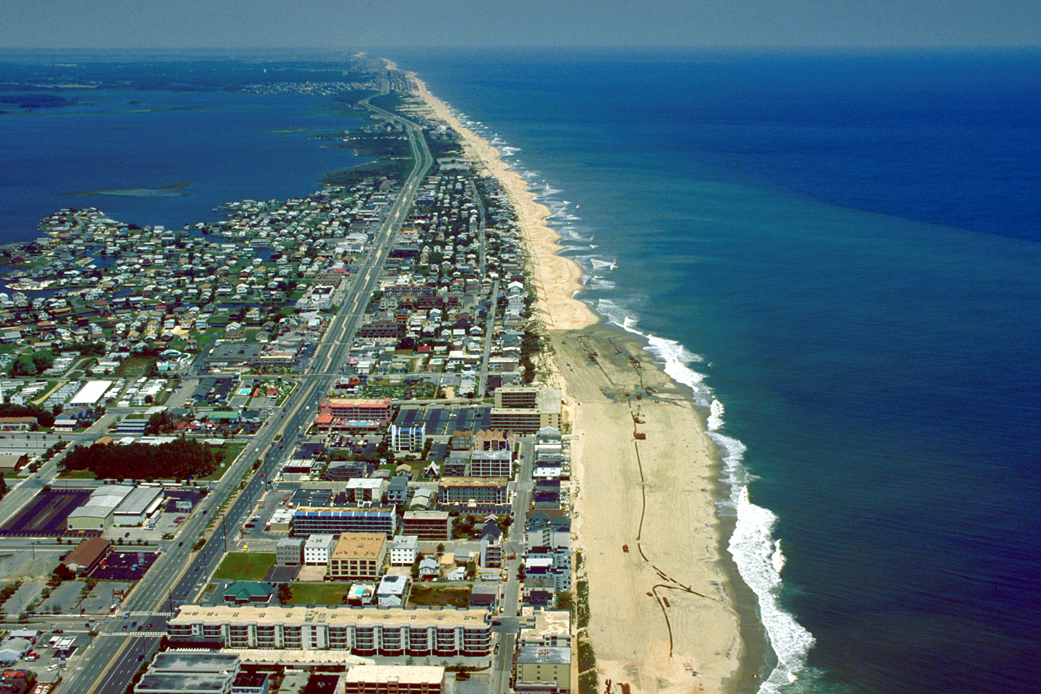
English: Aerial view of Ocean City, Maryland, USA. View is to the north-northeast. |
|||
| Date | ||||
| Source |
U.S. Army Corps of Engineers Digital Visual Library Image page Image description page Digital Visual Library home page |
|||
| Author | Tex Jobe, U.S. Army Corps of Engineers | |||
| Permission (Reusing this file) |
|
|||
| Location | Ocean City, Maryland, USA |
| Camera location | | View this and other nearby images on: OpenStreetMap |
|---|
ཡིག་ཆའི་ལོ་རྒྱུས།
ཟླ་ཚེས་/དུས་ཚོད་གནུན་ཏེ་རྩོམ་ཡིག་ལ་ལྟ་བ།
| ཚེས་གྲངས། / དུས་ཚོད། | བསྡུས་དོན། | ཚད། | སྤྱོད་མི། | བསམ་ཚུལ། | |
|---|---|---|---|---|---|
| ད་ལྟ། | ༠༡:༡༠, ༨ ཟླ་བཞི་བ། ༢༠༠༧ | | ༡,༥༠༠ × ༡,༠༠༡ (༧༥༣ KB) | DanMS | {{Information | Description = {{en|Aerial view of Ocean City, Maryland, USA. View is to the north-northeast.}} | Source = U.S. Army Corps of Engineers Digital Visual Library<br />[http://images.usace.army.mil/images/Hires/0454-12.Jpg Image page |
ཡིག་ཆ་བེད་སྤྱོད་ཁུལ།
pagelinks འདི་ལ་སྦྲེལ་ཡོད།
Global file usage
The following other wikis use this file:
- Usage on ar.wikipedia.org
- Usage on bg.wikipedia.org
- Usage on ca.wikipedia.org
- Usage on de.wikipedia.org
- Usage on en.wikipedia.org
- Usage on es.wikipedia.org
- Usage on fa.wikipedia.org
- Usage on fr.wikipedia.org
- Usage on hak.wikipedia.org
- Usage on hi.wikipedia.org
- Usage on hu.wikipedia.org
- Usage on ilo.wikipedia.org
- Usage on is.wikipedia.org
- Usage on it.wikipedia.org
- Usage on ja.wikipedia.org
- Usage on kn.wikipedia.org
- Usage on pam.wikipedia.org
- Usage on pl.wikipedia.org
- Usage on pt.wikipedia.org
- Usage on tr.wikipedia.org
- Usage on ur.wikipedia.org
- Usage on zh.wikipedia.org