File:Punakha Bhutan location map.png

Size of this preview: ༨༠༠ × ༥༢༢ pixels. Other resolutions: ༣༢༠ × ༢༠༩ pixels | ༦༤༠ × ༤༡༨ pixels | ༡,༠༢༤ × ༦༦༨ pixels | ༡,༢༨༠ × ༨༣༥ pixels | ༢,༠༠༠ × ༡,༣༠༥ pixels.
ཐོག་མའི་ཡིག་ཆ། (༢,༠༠༠ × ༡,༣༠༥ བརྙན་རྒྱུ།, ཡིག་ཆ་ཆེ་ཆུང།: ༥༢༨ KB, རྣམ་གཞག།: image/png)
བསྡུས་དོན།
| Description |
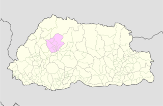
English: Punakha Bhutan location map |
| Date | |
| Source | User:NordNordWest, Bhutan Election and Demarcation Commissions |
| Author | User:NordNordWest, Government of Bhutan |
གན་རྒྱ་ནང་ཞུགས་པ།
This file is licensed under the Creative Commons Attribution-Share Alike 3.0 Unported license.
- You are free:
- to share – to copy, distribute and transmit the work
- to remix – to adapt the work
- Under the following conditions:
- attribution – You must give appropriate credit, provide a link to the license, and indicate if changes were made. You may do so in any reasonable manner, but not in any way that suggests the licensor endorses you or your use.
- share alike – If you remix, transform, or build upon the material, you must distribute your contributions under the same or compatible license as the original.
ཡིག་ཆའི་ལོ་རྒྱུས།
ཟླ་ཚེས་/དུས་ཚོད་གནུན་ཏེ་རྩོམ་ཡིག་ལ་ལྟ་བ།
| ཚེས་གྲངས། / དུས་ཚོད། | བསྡུས་དོན། | ཚད། | སྤྱོད་མི། | བསམ་ཚུལ། | |
|---|---|---|---|---|---|
| ད་ལྟ། | ༢༠:༤༣, ༣༡ ཟླ་བདུན་པ། ༢༠༡༡ | | ༢,༠༠༠ × ༡,༣༠༥ (༥༢༨ KB) | JFHJr |
ཡིག་ཆ་བེད་སྤྱོད་ཁུལ།
pagelinks འདི་ལ་སྦྲེལ་ཡོད།
Global file usage
The following other wikis use this file:
- Usage on ar.wikipedia.org
- Usage on bn.wikipedia.org
- Usage on ceb.wikipedia.org
- Usage on de.wikipedia.org
- Usage on en.wikipedia.org
- Punakha District
- Gewogs of Bhutan
- Chiwogs of Bhutan
- Toepisa Gewog
- Chhubu Gewog
- Dzomi Gewog
- Goenshari Gewog
- Guma Gewog
- Kabjisa Gewog
- Lingmukha Gewog
- Shenga Bjime Gewog
- Talog Gewog
- Toewang Gewog
- Barp Gewog
- Module:Location map/data/Bhutan Punakha/doc
- List of villages in Bhutan
- Module:Location map/data/Bhutan Punakha
- Usage on eo.wikipedia.org
- Usage on fa.wikipedia.org
- Usage on fr.wikipedia.org
- Usage on hi.wikipedia.org
- Usage on id.wikipedia.org
- Usage on ja.wikipedia.org
- Usage on kn.wikipedia.org
- Usage on pl.wikipedia.org
- Usage on pnb.wikipedia.org
- Usage on ps.wikipedia.org
- Usage on ru.wikipedia.org
View more global usage of this file.